| Photo Gallery Demolition and Other Main Street Scenes |
||
|
|
||
|
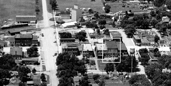
The black and white aerial photo below was submitted by
Joel Freeman (RHS class of 1956). It was taken from the east side of Rolfe
with the camera facing west.
In his e-mail letter accompanying the photo, Joel said, " I think this picture may be from the 20s or 30? I can see the back of the restaurant and hotel my folks had in the 40s, the old fire station at the bottom of the water tower, and Grant's Lumber Yard (upper left corner). When you look at this picture you get an idea of how much history is gone now. Very sad I think." Perhaps some of your other readers can help date the photo. There are some small grain bins on the far side of the grain elevator, which could lead a person to think the photo was from an era when the government was beginning to store large quantities of grain. That would probably make the photo later than the 20s and 30s. The white triangle marks the building (scene from the back side) that was torn down on August 29, 2001. Thanks for the photo, Joel. We're hoping that readers will begin to send in some of their memories and other reflections about Main Street life in Rolfe. Either e-mail or mail via the Postal Service to Helen Gunderson. or post them on the forum page, or come to the chat room on Saturday nights at 9 pm Iowa time. |
||
|
||
|
|
||
| The
first section of photos below was taken by Linda
Boeckholt Tiernan of Rolfe (RHS 1968) on the day of the razing of the tall brick building on the east side of Main Street (see area in white rectangle in above photo). The photos were posted on the web site on September 6, 2001. Thanks for sending them, Linda. |
||
|
|
||
|
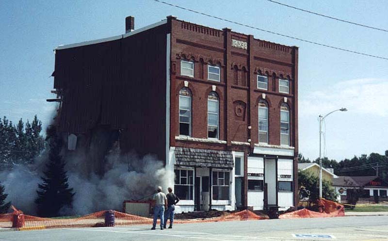
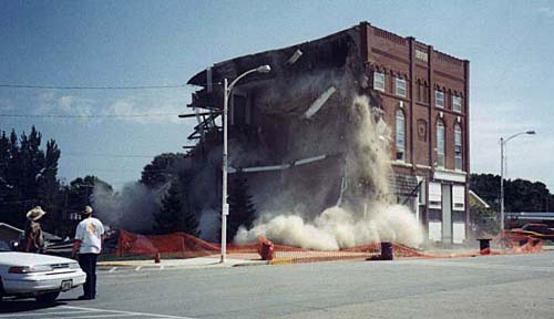
Camera faces southeast toward the tall brick building. | |
|
Camera faces southeast toward the tall brick building. | |
|
Camera faces southeast toward the tall brick building. | |
|
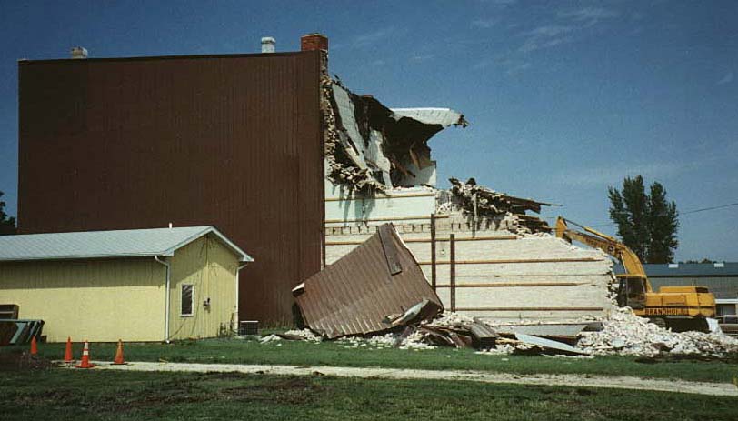
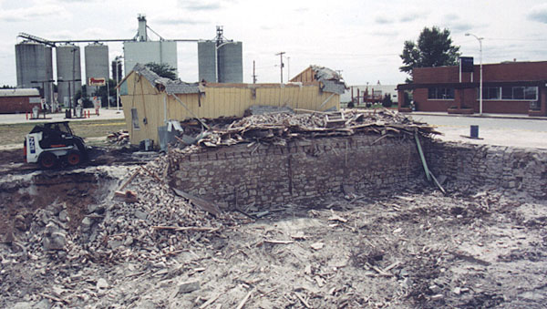
Camera faces north with Charles Gunderson's small yellow office to the left of the photo with machinery working on the back half of the the tall brick building. | |
|
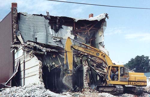
Camera faces west, northwest machinery working on the back half of the the tall brick building. | |
|
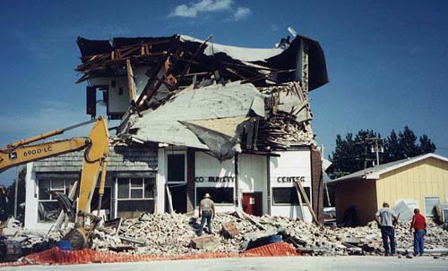
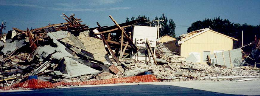
Camera faces east toward tall brick building which is about to collapse. Charles' office is to the far right. The sign for the community center are visible on the right half of the brick building. | |
|
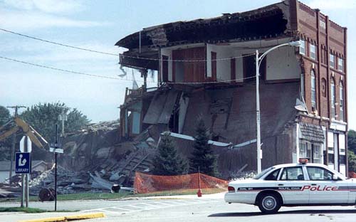
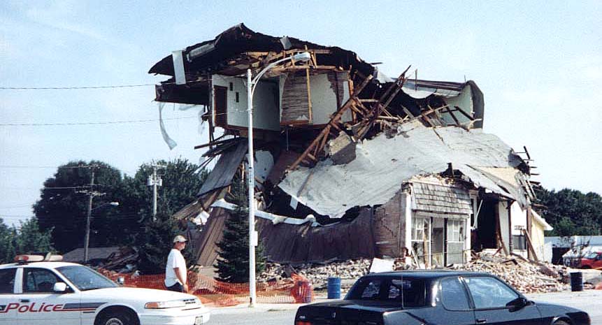
Camera faces southeast toward tall brick building which is about to collapse. Note the upstairs rooms. Apparently at one time, the Masonic Temple occupied the second and third floors. | |
|
Camera faces east toward rubble from the collapsed building with Charles' office on the right. | |
|
|
||
| The
photos below were taken by Helen Gunderson in the days following the collapse and were posted on the web site on September 5, 2001. |
||
|
Camera faces southwest over the excavated lot where the tall building stood until August 29, 2001. The Rolfe State Bank is the brown brick building on the far right. Charles Gunderson's law office is the small yellow building whose roof has collapsed. The Pronto station is to the left, and the Pro Coop grain elevators are in the distance. | |
|
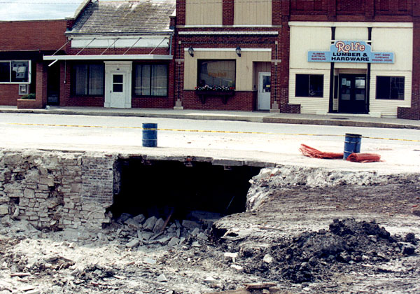
Camera faces west, southwest toward buildings on the west side of Main Street. The Rolfe Lumber Store is on the right. City Hall is in the middle, and the former Iowa Electric building is on the left. Charles may set up his office temporarily in the vacant IE building but the bank (on the extreme left of photo) has bought it with plans for a future extension of bank office space. Note the cavern for a coal bin under the street. | |
|
Camera faces east. Close your eyes and imagine Webb's Drug Store across the street (or later the Gift Galley). And recall the memories the store brings to mind. Then open your eyes and see the space left by the razing of the building. This is where Rolfe's multi-purpose facility will be built with library, city offices, and a community center. | |
|
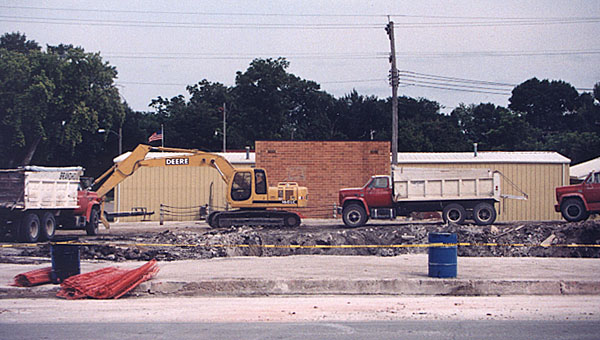
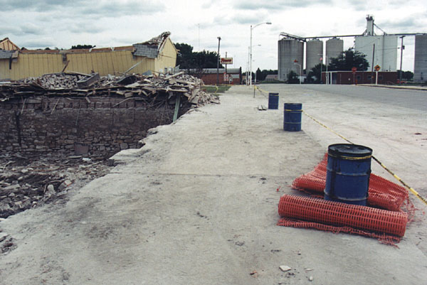
Sidewalk on east side of Main Street. Camera faces north. The site of the razed building is on the left then Charles' damaged yellow office then the Pronto Store then the old Chevy dealership in the distance that now houses Chris Cakes pancake service and the Wild Faces Gallery. On the right is the Post Office and grain elevators. | |
|
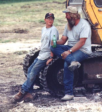
Alan Branhoij and his son take a break from cleaning up brick and other debris on the site of the razed building. | |
|
Camera faces north, northeast toward the corner with the public library on the right and other buildings along the route north out of town. Note the trees lining the street in the distance. They've always been one of the most beautiful scenes in town. The library was built in the 1960s. When the multi-purpose building is constructed, it will be the home of a new public ibrary, city offices, and a community center. |
|

|
Camera faces south, southwest toward the only brick buildings left on the main block of Main Street. First is the Rolfe Lumber Store, then City Hall which will move its offices into the new building, then the former Iowa Electric Building that will become an extension of the bank, then the Rolfe State Bank. In the distance is the Post Office and the Pro Coop grain elevators. | |
|
|
||
| If you have good photos and/or video footage of the actual razing of the tall building that are significantly different or better than the images above, would you be willing to loan us for posting on the web site or other use, please contact us. | ||
|
|
||
|
|
||
|
||